
Popayán topographic map
Interactive map
Click on the map to display elevation.
About this map
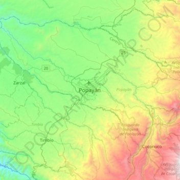
Name: Popayán topographic map, elevation, terrain.
Location: Popayán, Cauca, 190003, Colombia (2.28202 -76.76627 2.60202 -76.44627)
Average elevation: 6,529 ft
Minimum elevation: 3,819 ft
Maximum elevation: 12,070 ft
Other topographic maps
Click on a map to view its topography, its elevation and its terrain.