
Ciudad Guzmán topographic map
Interactive map
Click on the map to display elevation.
About this map
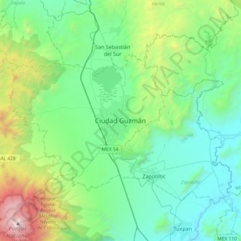
Name: Ciudad Guzmán topographic map, elevation, terrain.
Location: Ciudad Guzmán, Zapotlán el Grande, Jalisco, 49070, Mexico (19.54016 -103.62394 19.86016 -103.30394)
Average elevation: 5,719 ft
Minimum elevation: 3,474 ft
Maximum elevation: 13,911 ft