
Mission Viejo topographic map
Interactive map
Click on the map to display elevation.
About this map
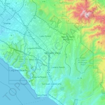
Name: Mission Viejo topographic map, elevation, terrain.
Average elevation: 860 ft
Minimum elevation: 0 ft
Maximum elevation: 5,663 ft
Other topographic maps
Click on a map to view its topography, its elevation and its terrain.
Canyon Crest
United States > California > Orange County > Mission Viejo
Canyon Crest, Mission Viejo, Orange County, California, United States
Average elevation: 873 ft