
Silver Peak topographic map
Interactive map
Click on the map to display elevation.
About this map
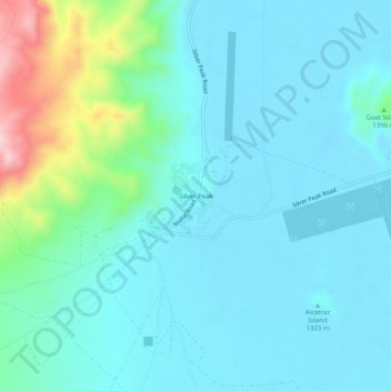
Name: Silver Peak topographic map, elevation, terrain.
Average elevation: 4,429 ft
Minimum elevation: 4,249 ft
Maximum elevation: 5,295 ft
Other topographic maps
Click on a map to view its topography, its elevation and its terrain.
Dyer
United States > Nevada > Esmeralda County
Dyer, Esmeralda County, Nevada, 89010, United States
Average elevation: 4,902 ft
Lida
United States > Nevada > Esmeralda County
Lida, Esmeralda County, Nevada, United States
Average elevation: 6,447 ft
Goat Island
United States > Nevada > Esmeralda County
Goat Island, Esmeralda County, Nevada, 89047, United States
Average elevation: 4,275 ft
Goldfield
United States > Nevada > Esmeralda County > Goldfield
Goldfield, Esmeralda County, Nevada, 89013, United States
Average elevation: 5,833 ft