
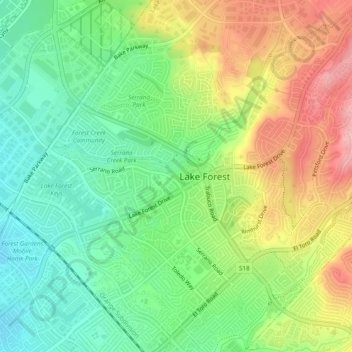
Serrano Place topographic map
Interactive map
Click on the map to display elevation.
About this map
Name: Serrano Place topographic map, elevation, terrain.
Average elevation: 515 ft
Minimum elevation: 315 ft
Maximum elevation: 801 ft
Other topographic maps
Click on a map to view its topography, its elevation and its terrain.
Portola Hills
United States > California > Orange County > Lake Forest
Portola Hills, Lake Forest, Orange County, CAL Fire Southern Region, California, United States
Average elevation: 1,178 ft