
Rocksprings topographic map
Interactive map
Click on the map to display elevation.
About this map
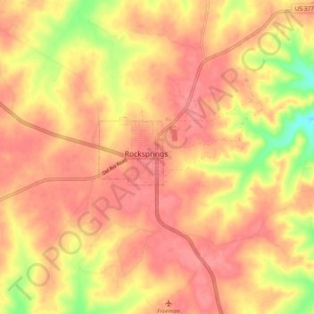
Name: Rocksprings topographic map, elevation, terrain.
Location: Rocksprings, Edwards County, Texas, 78880, United States (29.97576 -100.24536 30.05576 -100.16536)
Average elevation: 2,359 ft
Minimum elevation: 2,195 ft
Maximum elevation: 2,428 ft