
Oakdale topographic map
Interactive map
Click on the map to display elevation.
About this map
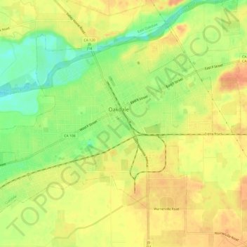
Name: Oakdale topographic map, elevation, terrain.
Average elevation: 171 ft
Minimum elevation: 85 ft
Maximum elevation: 226 ft
Historically the area has been used for orchards and other agricultural uses. Some of the common soil types found in Oakdale are Delhi sand, Oakdale sandy loam, Hanford sandy loam, and Tujunga loamy sand. Oakdale is generally on level ground at an elevation of approximately 190 feet (58 m) above mean sea level. Drainage is generally to the northwest towards the Stanislaus River.