Girwood (site) topographic map
Interactive map
Click on the map to display elevation.
About this map
Name: Girwood (site) topographic map, elevation, terrain.
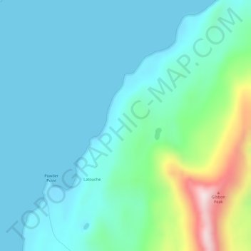
Average elevation: 315 ft
Minimum elevation: -7 ft
Maximum elevation: 1,706 ft

Click on the map to display elevation.
Name: Girwood (site) topographic map, elevation, terrain.
Average elevation: 315 ft
Minimum elevation: -7 ft
Maximum elevation: 1,706 ft