
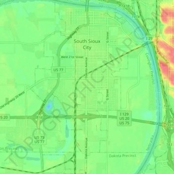
South Sioux City topographic map
Interactive map
Click on the map to display elevation.
About this map
Name: South Sioux City topographic map, elevation, terrain.
Average elevation: 1,099 ft
Minimum elevation: 1,020 ft
Maximum elevation: 1,234 ft
In contrast to its hilly larger neighbor, South Sioux City is relatively flat. The difference in elevation across most of the city is less than 20 feet, generally ranging between 1,085 and 1,105 feet above sea level.