
Lancaster topographic map
Interactive map
Click on the map to display elevation.
About this map
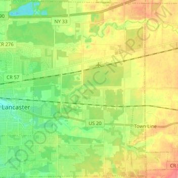
Name: Lancaster topographic map, elevation, terrain.
Average elevation: 735 ft
Minimum elevation: 636 ft
Maximum elevation: 860 ft
Other topographic maps
Click on a map to view its topography, its elevation and its terrain.
East Lancaster
United States > New York > Erie County > Town of Lancaster
East Lancaster, Town of Lancaster, Erie County, New York, 14086, United States
Average elevation: 709 ft
Bowmansville
United States > New York > Erie County > Town of Lancaster
Bowmansville, Town of Lancaster, Erie County, New York, 14026, United States
Average elevation: 705 ft
Village of Depew
United States > New York > Erie County > Town of Lancaster
Village of Depew, Town of Lancaster, Erie County, New York, 14043, United States
Average elevation: 682 ft