
Vermillion topographic map
Interactive map
Click on the map to display elevation.
About this map
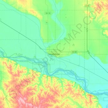
Name: Vermillion topographic map, elevation, terrain.
Location: Vermillion, Clay County, South Dakota, 57069, United States (42.61953 -97.08910 42.93953 -96.76910)
Average elevation: 1,243 ft
Minimum elevation: 1,099 ft
Maximum elevation: 1,640 ft
The elevation of the city is 1,221 feet (372 m).