
Saint-Eustache topographic map
Interactive map
Click on the map to display elevation.
About this map
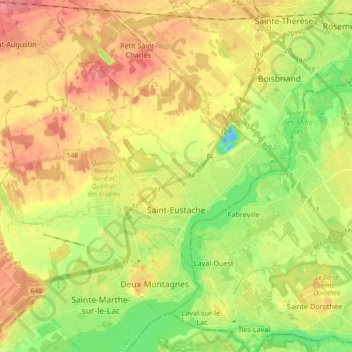
Name: Saint-Eustache topographic map, elevation, terrain.
Average elevation: 121 ft
Minimum elevation: -46 ft
Maximum elevation: 236 ft
Other topographic maps
Click on a map to view its topography, its elevation and its terrain.
Lake of Two Mountains
Canada > Quebec > Deux-Montagnes (MRC) > Oka
Lake of Two Mountains, Oka, Deux-Montagnes (MRC), Laurentides, Quebec, Canada
Average elevation: 141 ft
Pointe-Calumet
Canada > Quebec > Deux-Montagnes (MRC)
Pointe-Calumet, Deux-Montagnes (MRC), Laurentides, Quebec, Canada
Average elevation: 82 ft
Sainte-Marthe-sur-le-Lac
Canada > Quebec > Deux-Montagnes (MRC)
Sainte-Marthe-sur-le-Lac, Deux-Montagnes (MRC), Laurentides, Quebec, J0N 1P0, Canada
Average elevation: 89 ft