
Dieppe topographic map
Interactive map
Click on the map to display elevation.
About this map
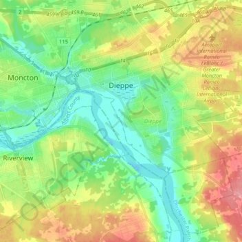
Name: Dieppe topographic map, elevation, terrain.
Average elevation: 118 ft
Minimum elevation: -7 ft
Maximum elevation: 315 ft
Other topographic maps
Click on a map to view its topography, its elevation and its terrain.
Riverfront Park
Canada > New Brunswick > Moncton Parish > Moncton
Riverfront Park, Moncton, Moncton Parish, Westmorland County, New Brunswick, Canada
Average elevation: 39 ft
Moncton
Canada > New Brunswick > Moncton Parish
Moncton, Moncton Parish, Westmorland County, New Brunswick, Canada
Average elevation: 171 ft