
Lumberton topographic map
Interactive map
Click on the map to display elevation.
About this map
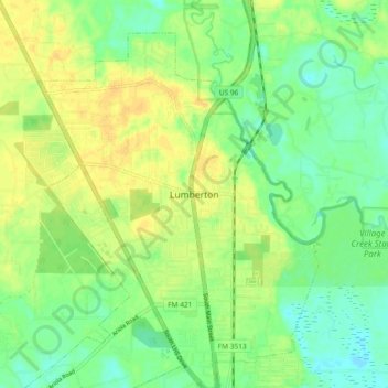
Name: Lumberton topographic map, elevation, terrain.
Location: Lumberton, Hardin County, Texas, 77657, United States (30.22553 -94.23914 30.30553 -94.15914)
Average elevation: 46 ft
Minimum elevation: 3 ft
Maximum elevation: 85 ft