
Raytown topographic map
Interactive map
Click on the map to display elevation.
About this map
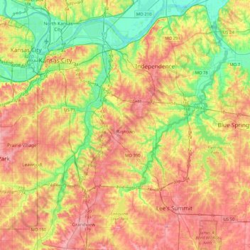
Name: Raytown topographic map, elevation, terrain.
Location: Raytown, Jackson County, Missouri, 64133, United States (38.85684 -94.62305 39.17684 -94.30305)
Average elevation: 899 ft
Minimum elevation: 705 ft
Maximum elevation: 1,096 ft
Other topographic maps
Click on a map to view its topography, its elevation and its terrain.
Shady Lake
United States > Missouri > Jackson County > Raytown
Shady Lake, Raytown, Jackson County, Missouri, United States
Average elevation: 915 ft