
Wichita topographic map
Interactive map
Click on the map to display elevation.
About this map
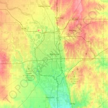
Name: Wichita topographic map, elevation, terrain.
Location: Wichita, Sedgwick County, Kansas, 67202, United States (37.53224 -97.49754 37.85224 -97.17754)
Average elevation: 1,345 ft
Minimum elevation: 1,234 ft
Maximum elevation: 1,457 ft
Other topographic maps
Click on a map to view its topography, its elevation and its terrain.
Minneha
United States > Kansas > Sedgwick County > Wichita
Minneha, Wichita, Sedgwick County, Kansas, 67206, United States
Average elevation: 1,388 ft