
Kennewick topographic map
Interactive map
Click on the map to display elevation.
About this map
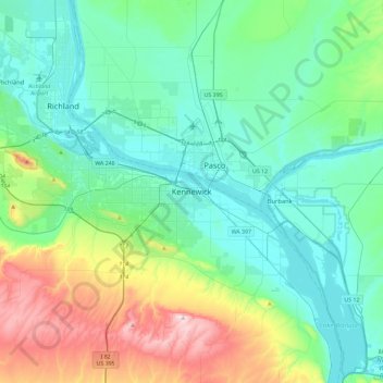
Name: Kennewick topographic map, elevation, terrain.
Location: Kennewick, Benton County, Washington, 99337, United States (46.04871 -119.27992 46.36871 -118.95992)
Average elevation: 735 ft
Minimum elevation: 305 ft
Maximum elevation: 2,198 ft