
Cuauhtémoc topographic map
Interactive map
Click on the map to display elevation.
About this map
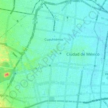
Name: Cuauhtémoc topographic map, elevation, terrain.
Location: Cuauhtémoc, Mexico City, Mexico (19.39979 -99.18430 19.46571 -99.12225)
Average elevation: 7,339 ft
Minimum elevation: 7,313 ft
Maximum elevation: 7,464 ft
Other topographic maps
Click on a map to view its topography, its elevation and its terrain.
Parque España
Parque España, Condesa, Cuauhtémoc, Mexico City, 06140, Mexico
Average elevation: 7,356 ft
Island of the Dead Dolls
Island of the Dead Dolls, Xochimilco, Mexico City, 16043, Mexico
Average elevation: 7,333 ft
Bosque de Chapultepec
Bosque de Chapultepec, Mexico City, 11590, Mexico
Average elevation: 7,533 ft