
Mahiyanganaya topographic map
Interactive map
Click on the map to display elevation.
About this map
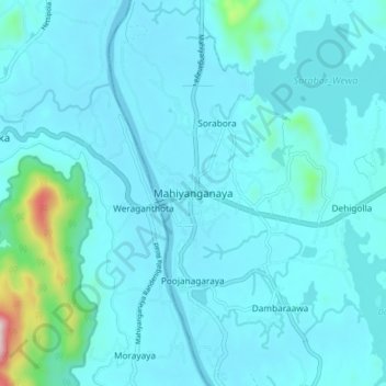
Name: Mahiyanganaya topographic map, elevation, terrain.
Location: Mahiyanganaya, Badulla District, Uva Province, 90700, Sri Lanka (7.30007 80.95288 7.38007 81.03288)
Average elevation: 404 ft
Minimum elevation: 240 ft
Maximum elevation: 2,169 ft