
Lans topographic map
Interactive map
Click on the map to display elevation.
About this map
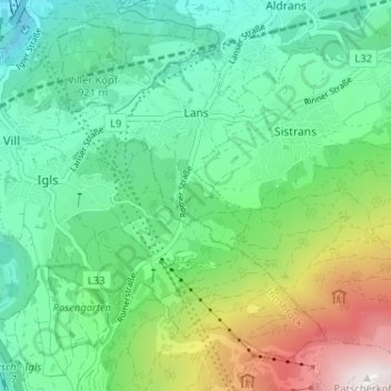
Name: Lans topographic map, elevation, terrain.
Location: Lans, Innsbruck-Land, Tirol, 6072, Österreich (47.20984 11.40956 47.24851 11.47407)
Average elevation: 3,507 ft
Minimum elevation: 1,972 ft
Maximum elevation: 7,382 ft