
Kelvingrove Park topographic map
Interactive map
Click on the map to display elevation.
About this map
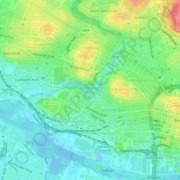
Name: Kelvingrove Park topographic map, elevation, terrain.
Average elevation: 82 ft
Minimum elevation: -49 ft
Maximum elevation: 246 ft
Other topographic maps
Click on a map to view its topography, its elevation and its terrain.
White Cart Water
United Kingdom > Scotland > Glasgow City > Glasgow
White Cart Water, Glasgow, Glasgow City, Scotland, United Kingdom
Average elevation: 410 ft