
Texada Island topographic map
Interactive map
Click on the map to display elevation.
About this map
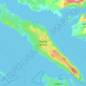
Name: Texada Island topographic map, elevation, terrain.
Average elevation: 272 ft
Minimum elevation: -3 ft
Maximum elevation: 4,160 ft
Other topographic maps
Click on a map to view its topography, its elevation and its terrain.
Priest Lake
Canada > British Columbia > qathet Regional District > Area D (Texada Island) > Van Anda
Priest Lake, Van Anda, Area D (Texada Island), qathet Regional District, British Columbia, Canada
Average elevation: 335 ft