
Fuerteventura topographic map
Interactive map
Click on the map to display elevation.
About this map
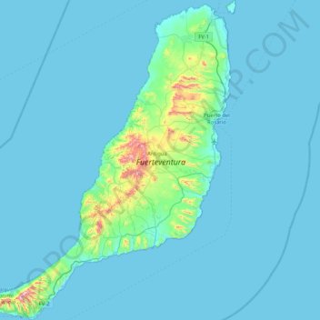
Name: Fuerteventura topographic map, elevation, terrain.
Location: Fuerteventura, Antigua, Las Palmas, Canary Islands, Spain (28.04351 -14.50975 28.76599 -13.81075)
Average elevation: 144 ft
Minimum elevation: -3 ft
Maximum elevation: 2,539 ft