
Lake Highlands topographic map
Interactive map
Click on the map to display elevation.
About this map
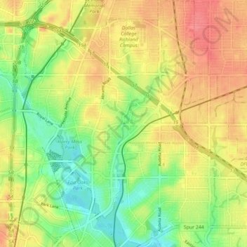
Name: Lake Highlands topographic map, elevation, terrain.
Average elevation: 574 ft
Minimum elevation: 463 ft
Maximum elevation: 676 ft
The neighborhood differs from much of Dallas and the surrounding area, which is fairly flat. Lake Highlands has hills and valleys, with street elevations that can vary by 50 feet, which offer scenic views of downtown Dallas.