
Waterford topographic map
Interactive map
Click on the map to display elevation.
About this map
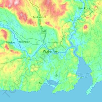
Name: Waterford topographic map, elevation, terrain.
Location: Waterford, County Waterford, Munster, X91 XH5R, Ireland (52.10100 -7.27191 52.42100 -6.95191)
Average elevation: 187 ft
Minimum elevation: -13 ft
Maximum elevation: 1,024 ft
Other topographic maps
Click on a map to view its topography, its elevation and its terrain.
Grantstown
Grantstown, Farranshoneen, Waterford City Metropolitan District, Waterford, County Waterford, Munster, Ireland
Average elevation: 98 ft