
Lubumbashi topographic map
Interactive map
Click on the map to display elevation.
About this map
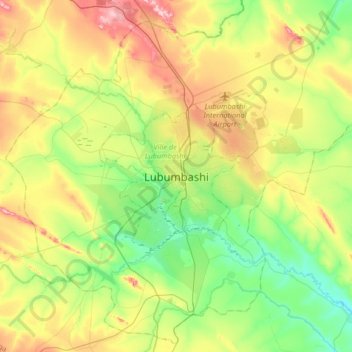
Name: Lubumbashi topographic map, elevation, terrain.
Average elevation: 4,131 ft
Minimum elevation: 3,829 ft
Maximum elevation: 4,629 ft
Other topographic maps
Click on a map to view its topography, its elevation and its terrain.
Kinkole
Democratic Republic of the Congo > Haut-Katanga > Ville de Lubumbashi > Lubumbashi
Kinkole, Mampala, Lubumbashi, Ville de Lubumbashi, Haut-Katanga, Democratic Republic of the Congo
Average elevation: 3,980 ft