
Grinnell topographic map
Interactive map
Click on the map to display elevation.
About this map
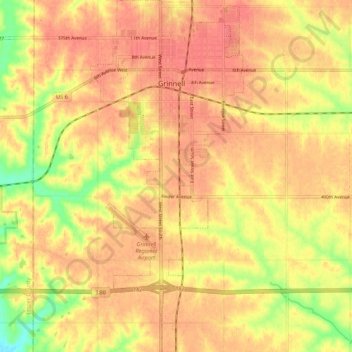
Name: Grinnell topographic map, elevation, terrain.
Location: Grinnell, Poweshiek County, Iowa, 50112, United States (41.68138 -92.74902 41.76204 -92.70188)
Average elevation: 981 ft
Minimum elevation: 846 ft
Maximum elevation: 1,043 ft
Other topographic maps
Click on a map to view its topography, its elevation and its terrain.
Brooklyn
United States > Iowa > Poweshiek County
Brooklyn, Poweshiek County, Iowa, United States
Average elevation: 866 ft
Deep River
United States > Iowa > Poweshiek County
Deep River, Poweshiek County, Iowa, United States
Average elevation: 869 ft