
Oslo topographic map
Interactive map
Click on the map to display elevation.
About this map
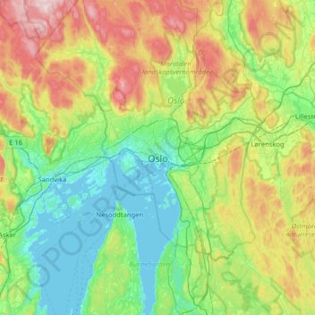
Name: Oslo topographic map, elevation, terrain.
Location: Oslo, 0026, Norway (59.75333 10.57897 60.07333 10.89897)
Average elevation: 610 ft
Minimum elevation: -3 ft
Maximum elevation: 2,093 ft
Other topographic maps
Click on a map to view its topography, its elevation and its terrain.