
Ernakulam topographic map
Interactive map
Click on the map to display elevation.
About this map
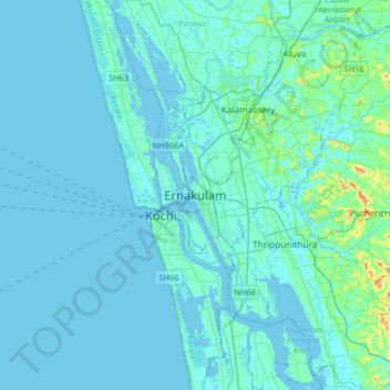
Name: Ernakulam topographic map, elevation, terrain.
Average elevation: 20 ft
Minimum elevation: -16 ft
Maximum elevation: 246 ft
The Ernakulam District is situated in Central Kerala in India. Ernakulam is located at 9°59′N 76°17′E / 9.98°N 76.28°E / 9.98; 76.28. It has an average elevation of 4 m (13 ft).
Other topographic maps
Click on a map to view its topography, its elevation and its terrain.
Udayamperoor
India > Kerala > Kanayannur
Udayamperoor, Kanayannur, Ernakulam District, Kerala, 682305, India
Average elevation: 23 ft
Kakkanad
India > Kerala > Kanayannur > Kakkanad
Kakkanad, Kanayannur, Ernakulam district, Kerala, 682030, India
Average elevation: 43 ft