
Baildon topographic map
Interactive map
Click on the map to display elevation.
About this map
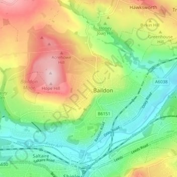
Name: Baildon topographic map, elevation, terrain.
Location: Baildon, Bradford, West Yorkshire, England, United Kingdom (53.83714 -1.80701 53.86893 -1.73604)
Average elevation: 482 ft
Minimum elevation: 180 ft
Maximum elevation: 925 ft