
Lakeview topographic map
Interactive map
Click on the map to display elevation.
About this map
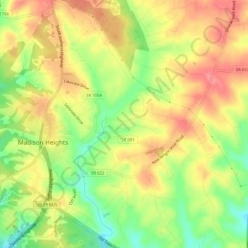
Name: Lakeview topographic map, elevation, terrain.
Location: Lakeview, Amherst County, Virginia, 24572, United States (37.41459 -79.12725 37.45459 -79.08725)
Average elevation: 761 ft
Minimum elevation: 614 ft
Maximum elevation: 876 ft