
Blain topographic map
Interactive map
Click on the map to display elevation.
About this map
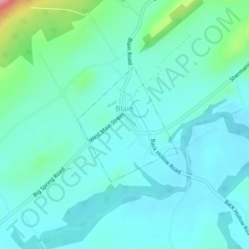
Name: Blain topographic map, elevation, terrain.
Location: Blain, Perry County, Pennsylvania, United States (40.33098 -77.51925 40.34350 -77.50499)
Average elevation: 751 ft
Minimum elevation: 663 ft
Maximum elevation: 1,171 ft
According to the United States Census Bureau, the borough has a total area of 0.3 square miles (0.78 km2), all of it land. Population is 286 (2000). Its highest point is Conegeuege mountain (1872 feet) its elevation is 750 feet on average.