
Shohola topographic map
Interactive map
Click on the map to display elevation.
About this map
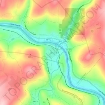
Name: Shohola topographic map, elevation, terrain.
Average elevation: 889 ft
Minimum elevation: 505 ft
Maximum elevation: 1,283 ft
Other topographic maps
Click on a map to view its topography, its elevation and its terrain.
Walker Lake
United States > Pennsylvania > Pike County > Shohola Township
Walker Lake, Shohola Township, Pike County, Pennsylvania, 18458, United States
Average elevation: 1,230 ft