
College Station topographic map
Interactive map
Click on the map to display elevation.
About this map
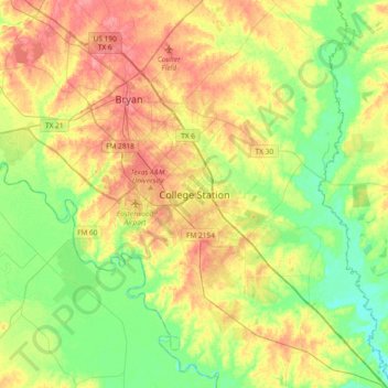
Name: College Station topographic map, elevation, terrain.
Average elevation: 269 ft
Minimum elevation: 164 ft
Maximum elevation: 400 ft
Other topographic maps
Click on a map to view its topography, its elevation and its terrain.
John Crompton Park
United States > Texas > Brazos County > College Station
John Crompton Park, Fox Run Condominiums, College Station, Brazos County, Texas, 77840, United States
Average elevation: 315 ft
Carter Lake
United States > Texas > Brazos County > College Station
Carter Lake, College Station, Brazos County, Texas, United States
Average elevation: 253 ft