
Camili topographic map
Interactive map
Click on the map to display elevation.
About this map
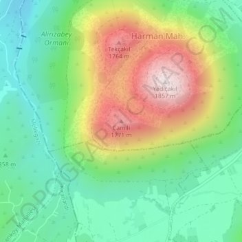
Name: Camili topographic map, elevation, terrain.
Location: Camili, Talas, Kayseri, Central Anatolia Region, 38280, Turkey (38.65854 35.54621 38.65864 35.54631)
Average elevation: 4,783 ft
Minimum elevation: 3,993 ft
Maximum elevation: 6,119 ft