
Sasthamkotta topographic map
Interactive map
Click on the map to display elevation.
About this map
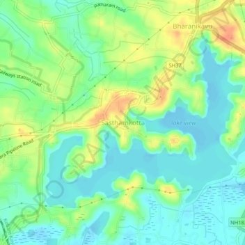
Name: Sasthamkotta topographic map, elevation, terrain.
Location: Sasthamkotta, Kunnathur, Kollam, Kerala, 690521, India (9.02395 76.60585 9.06395 76.64585)
Average elevation: 49 ft
Minimum elevation: -10 ft
Maximum elevation: 131 ft