
Doui topographic map
Interactive map
Click on the map to display elevation.
About this map
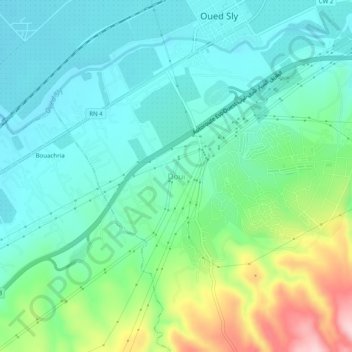
Name: Doui topographic map, elevation, terrain.
Location: Doui, Oued Sly, Daïra Boukadir, Chlef, 02011, Algérie (36.06330 1.17356 36.10330 1.21356)
Average elevation: 456 ft
Minimum elevation: 249 ft
Maximum elevation: 1,040 ft