
Somerville topographic map
Interactive map
Click on the map to display elevation.
About this map
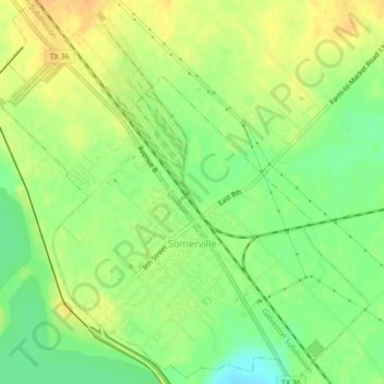
Name: Somerville topographic map, elevation, terrain.
Location: Somerville, Burleson County, Texas, United States (30.33050 -96.55053 30.36783 -96.50904)
Average elevation: 256 ft
Minimum elevation: 197 ft
Maximum elevation: 305 ft
Other topographic maps
Click on a map to view its topography, its elevation and its terrain.
Chriesman
United States > Texas > Burleson County
Chriesman, Burleson County, Texas, 77838, United States
Average elevation: 433 ft
Caldwell
United States > Texas > Burleson County
Caldwell, Burleson County, Texas, 77836, United States
Average elevation: 371 ft