
Shenandoah topographic map
Interactive map
Click on the map to display elevation.
About this map
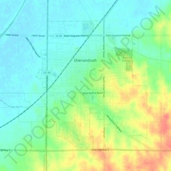
Name: Shenandoah topographic map, elevation, terrain.
Location: Shenandoah, Page County, Iowa, United States (40.74278 -95.40399 40.77553 -95.34703)
Average elevation: 1,017 ft
Minimum elevation: 948 ft
Maximum elevation: 1,148 ft
Other topographic maps
Click on a map to view its topography, its elevation and its terrain.
Blanchard
United States > Iowa > Page County
Blanchard, Page County, Iowa, United States
Average elevation: 1,001 ft