
Pinetop topographic map
Interactive map
Click on the map to display elevation.
About this map
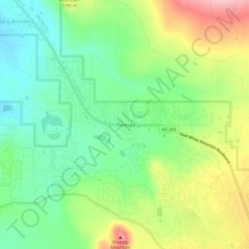
Name: Pinetop topographic map, elevation, terrain.
Average elevation: 7,024 ft
Minimum elevation: 6,781 ft
Maximum elevation: 7,418 ft
Other topographic maps
Click on a map to view its topography, its elevation and its terrain.
Lakeside
United States > Arizona > Navajo County > Pinetop-Lakeside
Lakeside, Pinetop-Lakeside, Navajo County, Arizona, 85929, United States
Average elevation: 6,755 ft