
Lakewood topographic map
Interactive map
Click on the map to display elevation.
About this map
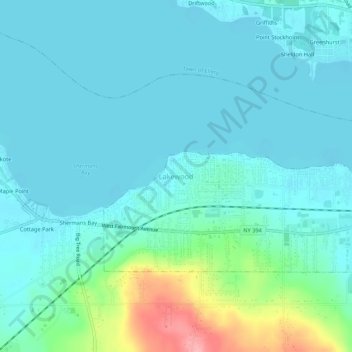
Name: Lakewood topographic map, elevation, terrain.
Location: Lakewood, Chautauqua County, New York, 14750, United States (42.08422 -79.35310 42.12422 -79.31310)
Average elevation: 1,365 ft
Minimum elevation: 1,299 ft
Maximum elevation: 1,667 ft