
Aurora topographic map
Interactive map
Click on the map to display elevation.
About this map
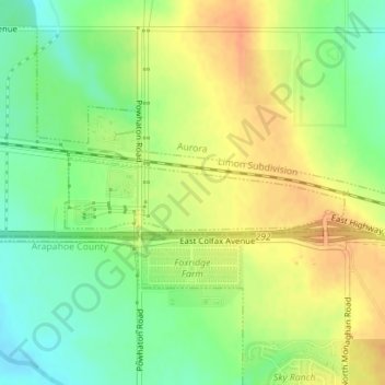
Name: Aurora topographic map, elevation, terrain.
Location: Aurora, Adams County, Colorado, United States (39.74060 -104.68511 39.74562 -104.65937)
Average elevation: 5,610 ft
Minimum elevation: 5,541 ft
Maximum elevation: 5,673 ft