
Dante topographic map
Interactive map
Click on the map to display elevation.
About this map
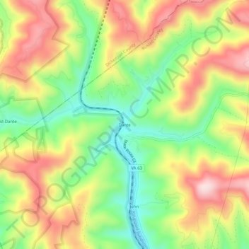
Name: Dante topographic map, elevation, terrain.
Location: Dante, Russell County, Virginia, United States (36.95844 -82.31764 36.99844 -82.27764)
Average elevation: 2,264 ft
Minimum elevation: 1,703 ft
Maximum elevation: 2,871 ft