Унжей-Аксы topographic map
Interactive map
Click on the map to display elevation.
About this map
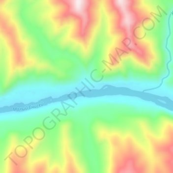
Name: Унжей-Аксы topographic map, elevation, terrain.
Average elevation: 3,425 ft
Minimum elevation: 2,733 ft
Maximum elevation: 4,557 ft

Click on the map to display elevation.
Name: Унжей-Аксы topographic map, elevation, terrain.
Average elevation: 3,425 ft
Minimum elevation: 2,733 ft
Maximum elevation: 4,557 ft