
Lehi topographic map
Interactive map
Click on the map to display elevation.
About this map
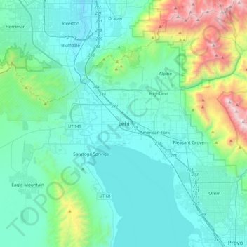
Name: Lehi topographic map, elevation, terrain.
Location: Lehi, Utah County, Utah, United States (40.22811 -112.00860 40.54811 -111.68860)
Average elevation: 5,518 ft
Minimum elevation: 4,324 ft
Maximum elevation: 11,667 ft