
Hohenlimburg topographic map
Interactive map
Click on the map to display elevation.
About this map
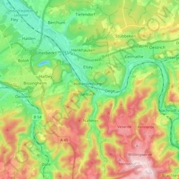
Name: Hohenlimburg topographic map, elevation, terrain.
Location: Hohenlimburg, Hagen, North Rhine-Westphalia, 58119, Germany (51.29562 7.48887 51.39922 7.59890)
Average elevation: 778 ft
Minimum elevation: 213 ft
Maximum elevation: 1,621 ft