
Sucikaler topographic map
Interactive map
Click on the map to display elevation.
About this map
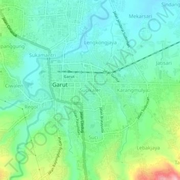
Name: Sucikaler topographic map, elevation, terrain.
Location: Sucikaler, West Java, 44115, Indonesia (-7.23747 107.88825 -7.19747 107.92825)
Average elevation: 2,392 ft
Minimum elevation: 2,254 ft
Maximum elevation: 2,769 ft