
Wheatland topographic map
Interactive map
Click on the map to display elevation.
About this map
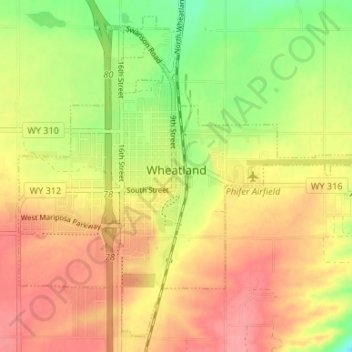
Name: Wheatland topographic map, elevation, terrain.
Location: Wheatland, Platte County, Wyoming, United States (42.03110 -104.98257 42.07592 -104.91618)
Average elevation: 4,770 ft
Minimum elevation: 4,619 ft
Maximum elevation: 4,882 ft
Other topographic maps
Click on a map to view its topography, its elevation and its terrain.
Glendo
United States > Wyoming > Platte County
Glendo, Platte County, Wyoming, United States
Average elevation: 4,751 ft