
Pentlepoir topographic map
Interactive map
Click on the map to display elevation.
About this map
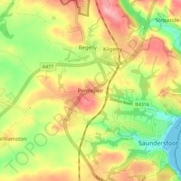
Name: Pentlepoir topographic map, elevation, terrain.
Location: Pentlepoir, Pembrokeshire, Wales, SA69 9BH, United Kingdom (51.70253 -4.74400 51.74253 -4.70400)
Average elevation: 184 ft
Minimum elevation: 0 ft
Maximum elevation: 361 ft