
Fair Park topographic map
Interactive map
Click on the map to display elevation.
About this map
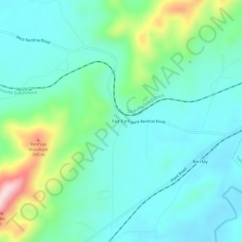
Name: Fair Park topographic map, elevation, terrain.
Location: Fair Park, Talladega County, Alabama, USA (33.40594 -86.20247 33.44594 -86.16247)
Average elevation: 699 ft
Minimum elevation: 459 ft
Maximum elevation: 1,496 ft